Showing posts with label Extended Trips. Show all posts

Saturday, 14 April 2012

Razor-Viking circuit from the Howqua

The rugged peaks and ranges in the heart of the Victorian High Country are a major drawcard for bushwalkers. The country here is consistently steep and rough; a marked contrast to the more rounded areas of the Australian Alps to the north-east. The jewel in the crown is the area located around Mount Howitt, a 1700m peak on the crest of the Great Dividing Range. Walkers flock to the narrow knife-edge ridge known as the Crosscut Saw, admire the views from Mount Howitt and enjoy the delights of Mount Speculation. Other landmarks in the area are less welcoming, featuring names such as the Terrible Hollow, Mount Despair, Horrible Gap, the Devil's Staircase, Mount Buggery and The Razor.

Most people access this spectacular area from the Howitt Plains, an alpine plateau located north of the remote mountain town of Licola. The high starting altitude provides relatively easy access to the area, and it is quite common to see young families doing day trips to Mount Howitt. It is also the starting point for one of the best four day walks in Victoria; the Razor-Viking circuit. Setting off from the Howitt Plains, this circuit heads clockwise around the crest of the mountain ranges, from Macalister Springs to Mount Howitt, across the Crosscut Saw to Mount Buggery and Speculation, down to Catherine Saddle, up over Mount Despair, across the southern flank of The Razor, then up through the cliffs to The Viking. From here bushwalkers descent from the ranges down into the depths of the Wonnangatta valley, before ascending 1000m back up to the Howitt Plains.

For those of us who live in Central Victoria accessing the Howitt Plains involves a rather lengthy drive that nearly circumnavigates the Alps. Instead, many of us opt to come in from the west via the town of Mansfield, saving several hours in travel. However, the reduced travel time comes at a price: altitude. Access from this side of the mountains involves starting from the valleys of the Howqua, Jamieson or King Rivers and climbing up to a thousand vertical meters to reach the crest of the range. It adds difficulty to the walks, but for some of us that's part of the attraction.

My goal for this trip was to complete the classic four day circuit from the west, starting and finishing at the Upper Howqua Camping Area.

Day 1 - Upper Howqua Camping Area to Mount Speculation

Following a late arrival in the wee hours of the morning, it took quite some effort to extract myself from bed and set out from the Upper Howqua Camping Area at 8am. The camping area itself was closed due to flood damage, with the old river crossing looking a little worse for wear.


The first 5km or so of walking entails following the Howqua River upstream along an old vehicle track. It's been closed to traffic for years, but some enterprising people in a 4WD have recently cut their way in along it. It required a substantial amount of effort in places, including filling in an erosion gully in order to get their cumbersome vehicles past.


Further upstream I noticed that the last remaining bridge on the track was missing, presumably having fallen victim to the recent floods. Fortunately others had provided stepping stones across the river instead, saving people from removing their boots for each crossing.

Upon reaching the base of the Howitt Spur walking track I turned left, following an old logging track up towards the crest of the Thorn Range. This track climbs at a steady pace but ducks and weaves all over the place, with false summits around seemingly every corner. At the actual crest I turned right along a walking track, heading up Stanley Name Spur. Passing over a slight hill and down through a small campsite perched in a saddle, the track then climbs straight up the side of one of the 'teeth' of the Crosscut Saw. The ascent is steep, and in places you need to use your hands to scramble up through the rocks - my kind of bushwalking!


After having lunch at the top of the spur, I set out along the well-worn foot track along the Crosscut Saw itself. The track ducks and weaves amongst the 'teeth', heading around some and straight over others. In places the ridge is quite narrow, making for spectacular walking.


The next major feature on the ridge north of the Crosscut Saw is Mount Buggery, with its rounded tree-clad summit providing an ideal campsite for those who are prepared to carry water. From the summit the track plummets down to Horrible Gap, before commencing a slightly gentler ascent up Mount Speculation. The south face of this mountain is particularly scenic.


One of the unique features of Mount Speculation is the amazing camping that is available, right on the edge of an escarpment overlooking the Terrible Hollow. I decided to take full advantage of this, so after resting briefly at the summit I headed north-east for a couple of hundred metres to a suitable location to pitch the tent. There were already a few tents set up, and I had seen a couple of parties making their way along the Crosscut Saw, so I staked my claim around 4:30pm and picked up some water from where the vehicle track crosses Camp Creek. Quickly cooked tea then went to bed at an early hour, hoping to catch up on lost sleep.

Day 2 - Mount Speculation to The Viking

One of the issues with camping in exposed locations is the drama that unfolds once the weather turns. Partway through the night the wind picked up significantly, to the point where I began to become concerned about the snowgums above my tent. Usually I have no problem with camping beneath snowgums as they usually only shed branches under heavy snow loading in the depths of winter. However, as I listened to each mighty gust of wind roaring in from the north and braced myself for each impact, I decided that it would be safer if I shifted my tent out of harms way in case the worst happened. Once this was done I could finally go back to sleep.

When dawn broke it was a glorious day, with the wind gone and nothing to distract me from the magnificent view from the campsite.


Broke camp and set off around 9am, opting to take the foot track along the ridge instead of the longer vehicle track. I was glad I did, as the scenery was magic. Spotted a fantastic chute down from the ridge into the Terrible Hollow, featuring a tight rocky entrance and an ideal orientation. I'd love to ski it someday.
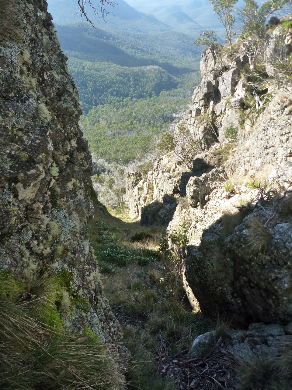

The track follows the ridge for around 1km before plummeting down the steep side of the hill to reach the vehicle track near Catherine Saddle. This descent, although brief, can be hard on your knees and I think people attempting to climb up it would have significant traction issues. Upon reaching the vehicle track I followed it around to Catherine Saddle itself, noting that someone had been down here with a 4WD recently. As it turned out it must have been a Parks Victoria vehicle, as the track heading east from the saddle had recently been cleared. This made progress very easy all the way to the tree-clad summit of Mount Despair. Partway up there was a gap in the trees, offering good views back towards the Crosscut Saw.


Upon reaching the summit I had a break, and was about to pack up and leave when I heard a noise nearby. Looking around, I spotted a friendly reptile that must have wanted a bit of company.


Descending from the summit, the track drops down to the crest of a rocky ridge leading to The Razor. The next stretch of track is very rugged and can be quite elusive. Generally the track sits below the crest of the ridge, but never drops down to the gully. Occasionally it gets close to the crest of the ridge, where there are views to the summit of the Razor itself.


Even though I'd walked this section of track before I still lost it towards the end, and had to climb up the hill to reach the ridge at the end of the Razor. Here I had a one hour lunch break, then continued along towards Viking Saddle. The track here had not been cleared, and regrowth through the decimated Ash forest was thick.


In places the track was hard to follow, but fortunately the second half of the track had been cleared, making the last section down to Viking Saddle itself quite easy. The saddle itself was as I remembered it, with the rocky cliffs of The Viking towering above it.


As I wanted to camp on the summit it was necessary to cart water from the bottom, so I set off down the foot track on the eastern side of the saddle, heading to the north in search of water to fill my containers. As on all my other visits to the area, water was found just before a little rocky escarpment that would form a waterfall after heavy rain. There must be a spring in the area, as not far upstream the creek bed was bone dry.

Returning to the saddle, I put the pack on and began the ascent up to The Viking itself. The ascent profile is similar to an exponential curve, starting off with a moderate gradient and getting steeper and steeper, until becoming near vertical towards the end where it passes through the rock band that forms the prominent cliffs. The track itself avoids the cliffs by heading up through a rugged chute, and in two sections passes through small caves formed by huge boulders.


At around 5:30pm I reached the summit, which is my favourite in Victoria. Despite its mere 1500m elevation, it feels like the top of the world.


I set off to the north and set up camp on a small grassy flat less than 50m away from the edge of the cliffs, started cooking dinner and then headed up to the edge of the cliffs to enjoy the sunset.


After the sun went down I could see the glow of a campfire down in Viking Saddle itself. If only the people down there knew what they were missing out on up at the summit. The temperature soon plummeted, so I retreated to the mild warmth offered by my 0ยบ sleeping bag. It must have reached that temperature at one point in the night, as at some stage I woke up and the fly was covered in ice.

Day 3 - The Viking to Macalister Springs

Awoke in the morning to a heavy dew and a saturated fly. The clear skies of the previous day had been replaced by broken cloud cover, depriving me of a scenic sunrise.


Setting off a little after 8am, I climbed back to the summit and began heading towards the South Viking, when I heard voices coming up the hill. It turned out to be two bushwalkers from Newcastle, John and Claire. They had spent the night at Viking Saddle and were hoping to get back to the carpark at Howitt Plains that evening, so we decided to stick together for the day.


Upon reaching the top of the South Viking, we began descending the spur down to the Wonnangatta River. The regrowth was much more mild than the previous day, and there was a decent footpad in a lot of places. We made good time to the river, arriving before midday.


There was little trace of the old vehicle track that once headed along the river, and both banks were covered in large quantities of blackberries. This made progress slow, with the only compensation being that the blackberries were ripe... and delicious.

From the river we had two options; follow the old vehicle track up to the Zeka Spur 4WD track and trudge through the dust, or cut up an unnamed and untracked spur to intersect the main spur above the 4WD track. We opted for the former, in case we could hitch a lift, and to avoid any regrowth issues.

The Zeka Spur track is one of the main 4WD access routes into the remote Wonnangatta valley, and Easter is one of the most popular times of year. Consequently the track and all the vegetation either side is covered in dust, with the lingering scent of diesel in the air. We had a brief lunch and then commenced the march up the track, which is steep, uninteresting and generally unpleasant. Only two vehicles passed us going in our direction, and neither stopped. The rest of the traffic was heading down the hill. At one stage a vehicle pulled over and a lady called out, 'Are you guys intentionally walking?'!!! Says a lot about the 4WD mentality. We were relieved to find the intersection of the old track and the new, marked by a small stone cairn on a sharp bend.


At this stage we were starting to feel a little weary, but there were still a number of kilometres to go, so on we went. We came across a couple of walkers camped in a saddle, who had walked down the track to the Wonnangatta the previous day and marched back out again that morning. One of them described the ascent as 'soul destroying'.

Further along the track began to climb at a steady grade, and at one point there were views back to where we had come from earlier in the day.


The ascent seemed to drag on and on, and it was getting cold by the time we reached the intersection with the track into Macalister Springs. Here I bid the John and Claire adieu and set off towards Macalister Springs. The track in had been churned up recently by some sort of wheeled vehicle; apparently they have been doing some work on the toilet.

By the time I reached the campsite it was dark, and after briefly stopping to absorb some warmth from a roaring campfire I started searching for a friend of mine, Gary, who had walked in for the evening. The hut was packed with people singing campfire songs which wasn't my kind of scene, so I explored further and ran into Gary standing around another campfire with three others; James, Jolie and Natahl. I quickly set up the tent nearby and returned to the fire to cook tea and be social. As the evening wore on the temperature kept dropping and the fire got progressively smokier, and eventually my weary body decreed that it was time for bed. Fair enough too; it had been a 20km day with well over 1000m of ascent.

Day 4 - Macalister Springs to Upper Howqua Camping Area

The weather had deteriorated somewhat overnight, leaving the morning cold and damp. There were intermittent showers of rain and ice, but no snow. Gary left bright and early in the morning, opting to retreat to the warmth of Licola for a cooked breakfast. In the absence of a fire and amidst the rather cool air I could certainly see the logic of his plan.


James and Jolie kindly invited me over to their spacious Hilleberg tent for breakfast, an offer which I graciously accepted. Their tent had quite a sculptural form, seemingly emerging from the ground similar the rounded top of a deeply embedded granite boulder. The clean lines were broken by the many guy ropes protruding from the tent like spines from an echidna.

Following an unusual entry procedure that favours the more agile members of society, I found myself contained within its yellow and green walls. Natahl joined us, creating a close-knit environment that I felt quite comfortable in... until James insisted that I cook inside the vestibule.

Now, as an MSR liquid fuel stove user and somebody who can have a quite conservative nature, this is something I'm never comfortable doing. I usually only cook in vestibules in the snow, and only after the vestibule has been dug out to provide more space. As an added precaution I opt to prime outside, lest the stove flare up and cause harm. Everyone's heard, seen or knows someone who's been involved with a liquid fuel accident and I would hate to be the cause of such an event. So you can imagine my apprehension about cooking in a brand new, extremely expensive tent with a bunch of people I barely knew, running the risk of turning the whole lot into a molten mess of nylon and flesh in a matter of seconds.

James was extremely good natured about the whole concept, insisting being able to cook in the vestibules was his number one selection criteria when choosing a tent, and that he would be using his XGK in the vestibule anyway, so what was the problem? I still couldn't bring myself to potentially cause harm to the tent, and after more banter Natahl encouraged me to "live a little, burn it down!”

Well, her statement floored me. How could I defend myself against that? So, nervously, I lit the stove. There was no excessive flame. The tent still stood, intact. We were still alive. Life went on. Goes to show you how sometimes you build these mental barriers that seem insurmountable, yet often they really aren't that big a deal and be easily conquered using a different mindset. I reflected on Natahl's "live a little" statement a lot over the next couple of days, and am definitely a better person for it.

Amongst much conversation and many cups of tea we consumed breakfast in a social manner, and all too soon I had to leave, as there was still a few kilometres to go until I reached the finishing point. Farewelling my companions, I set off towards Mount Howitt at around 10:45am. Occasional breaks in the cloud allowed tantalising glimpses of the previous days walking, including some great views back towards The Viking.


As I neared the summit I was surprised to see an unusual object just metres away from the survey mark; a tent. Not something you see every day up there, and certainly not in low visibility with the wind blasting through.


Here I faced a difficult decision; to continue on over Mount Magdala and head back to the car via one of my favourite routes, Helicopter Spur, or to descend directly down the less pleasant Howitt Spur and then along the Howqua River. The low temperature and strong winds soon chilled me off, so I opted for the more direct Howitt Spur route. A small gap in the clouds allowed me one last glimpse back across to the Crosscut Saw to The Razor and The Viking, and then I began the descent.


The rest of the walk was fairly straightforward, and I arrived back at the car just before 2:30pm. A check of the GPS revealed that I had ascended 3,850m over the walk and had covered 62.8km.

Reflections

This walk was simply fantastic. Considering it was one of the most popular times of year the crowd levels were quite acceptable, and the terrain covered second to none. The third day was longer and harder than many would like, but I believe that for a fit party it is perfectly achievable. In future I would head up the untracked spur instead of the Zeka Spur track, and would finish the walk by heading over Mount Magdala and descending via Helicopter Spur on the final day.

With these minor adjustments I believe this would be Victoria's ultimate four day circuit.

Friday, 13 January 2012

Kosciuszko to the Coast

It's been a while since I've undertaken a decent trip, so over the Christmas/New Year period I set off on a self-sufficient journey from Australia's highest mountain, Mt Kosciuszko, to the ocean; a total distance of some 250km. The journey consisted of two distinct stages; the first being a 75km walk from the small ski resort of Charlotte Pass to the Snowy River / Pinch River junction, and the second entailing paddling a packraft some 175km down the Snowy River to where it meets the ocean near the Victorian town of Marlo.

When I say self sufficient, I mean that everything that I needed for the trip, excluding water, was in my pack at the start. This included the usual camping equipment and 15 days food, plus a few unusual items you wouldn't associate with a walk from Mt Kosciuszko; a packraft, PFD, breakdown paddle and whitewater helmet. The total pack weight was around 35kg, so 20kg of equipment and 15kg of food.

The logistics of the trip were to leave my car at Orbost, then catching a bus up to Cooma. From here I had a friend deliver me to Charlotte Pass, some 100km away.

Day 1: Charlotte Pass to Seaman's Hut

We arrived at Charlotte Pass around 7:30pm. The Main Range was as beautiful as ever, with cloud intermingling with sunshine to create a fantastic vista, and the odd snowdrift still clinging to the side of the hills forming the icing on the cake. After a couple of quick photos and a long hug, I bid adieu to my dear travelling companion and started off along the track to Kosciuszko.


When walking along the track one can catch the occasional glimpse of the infant Snowy River, flowing wild and free. Barely a couple of kilometres below here the first of three dams intercept its waters, shoving them through hydroelectric power stations then delivering the majority to the other side of the mountains via long, dark tunnels.


Further along the track I crossed over the infant Snowy, drawing some water nearby, before continuing on to Seaman's Hut for the evening. With only two other people in residence I opted to sleep on the floor.

Day 2: Seaman's Hut to Cascade Hut

Waking early, I packed up my gear as quietly as I could and hit the track again around 6:15am.


Most of the range was under cloud cover, and on the approach to Rawsons Pass it quickly became apparent that there would be no view from the summit. Nevertheless, it needed to be climbed, so I dropped my pack and scrambled up the side with my paddle to take a few photos. As it turned out it was well worth the climb, with the mist adding an interesting atmosphere to the summit cairn.


Returning to Rawsons Pass, I saddled up and started pounding along the steel mesh walkway towards Thredbo. The cloud and mist lifted momentarily to reveal Lake Cootapatamba, one of Australia's highest lakes.


A little further along the walkway crosses the headwaters of the Snowy River; a small stream surrounded by snowgrass. I decided to stop and inflate the packraft, to prove that the one boat can indeed make it from summit to the sea!


Once the top of Thredbo became visible I veered off the walkway, and started off down a walking track towards Dead Horse Gap. The early start had paid dividends, as 5 minutes along the track I turned back and saw the many tourists starting out towards the summit, with each chair on the Kosciuszko Express chairlift bringing yet more people up from the village to experience the roof of Australia. Not my idea of fun.

The track dropped down to the carpark below Dead Horse Gap, crossing over the Alpine Way; the first of just four public roads that lay between here and the coast. This also marked the end of the walking track, with the rest of the walking leg of the journey to be undertaken on management trails.

After a quick lunch beside the Thredbo River I started the 200 vertical metre climb up over Bob's Ridge. Partway up the lack of sleep in the lead up to the trip caught up to me, so I had a nap in the shade of a snowgum before continuing the ascent. At the top the heavy pack was making its presence felt, and I was feeling every gram of weight by the time I reached Cascade Hut, my campsite for the evening. This horizontal slab structure was built by cattlemen in 1935 and was used as a base for summer grazing. Although the cattle are long gone, the hut remains and is a popular destination for walkers and MTB riders.


I shared the campsite with two other people, although must confess I was too tired to be social. It was an early night.

Day 3: Cascade Hut to Ingeegoodbee River

Following the previous days exertions my body was a little weary, so it was not until after 9am that I set out along the trail. The walking was fairly easy, at first through burnt ash forest from the 2003 fires, and then along the gently undulating crest of the Great Dividing Range, where the trail consisted of two grassy wheelruts amongst the snowgum woodland. Large piles of manure at irregular intervals indicated the presence of my companions for the next few days; mobs of brumbies (wild horses).

The weather was warm so I opted for a lengthly lunch in the shade of a tree through the hottest part of the day, then continued on to Tin Mine Huts. These huts were constructed around the same time as Cascade Hut, however for a different purpose. My favourite of the two remaining huts is the barn, a sizeable building with many interesting Australian bush architectural features.


When I was inside the barn filling in the logbook I heard some strange noises outside, in the distance. I wandered over to the people from Cascade Hut, who had shifted their campsite to here for the evening. They were kind enough to take a photo of me beneath the bulk of the pack.


Whilst chatting to them the noise came again; the unmistakable howl of wild dogs. We spotted one of the culprits a couple of hundred metres away, across the creek. As I was feeling okay, had plenty of daylight available and didn't fancy the thought of listening to wild dogs howling all night, I pushed on along the Ingeegoodbee Trail for a few more kilometres. The campsite was near the first ford of the Ingeegoodbee River, and I pitched my tarp close to the ground lest the wild dogs pay a visit. As a final safety measure I kept a section of my carbon fibre paddle shaft beside my bed; a decent tap with this rock-solid piece of tubing would send any dog yelping away into the bushes. Fortunately the evening was relatively peaceful, interrupted only by the occasional whine of the brumbies.

Day 4: Ingeegoodbee River to Nine Mile Pinch

My feet had a few tender spots the next morning. They were in an unusual place, around the midpoint of the foot and at the top. I put this down to the unusual flex pattern of the lightweight Dunlop Volleys I was wearing. Why Volleys? I wanted footwear that would grip on wet rocks in the gorges, and the humble Volley is one of the best. Plus the price was right, at a mere $10 per pair. Most of my whitewater paddling is done in Volleys, with the addition of woollen socks, neoprene socks and orthotics if more than a kilometre or two of walking is required. I've never had sore feet in them before, but had not worn them for such a long distance or with a load as heavy as the one I was carrying.

After packing up camp I opted to wear my alternative footwear for the day; foam Teva thongs. Heaven on your feet. The walking today was easy, along the Ingeegoodbee Trail with minimal climbing and pleasant sections along the river flats. The only detraction from the scenery was the damage caused by the brumbies. Every creek crossing has wide and trampled, their hoofs punching the fragile alpine soil into a muddy pulp. As the day was another hot one I had another long lunch, this time over 2 hours sitting cradled in a black sallee overlooking the river. A blissful existence.

Further on the country opens out onto a cleared grassy plain. It is in this area that the Freebody brothers used to graze cattle and grow potatoes in the days before Kosciuszko National Park was created. It's a beautiful location, with campsites in abundance.


The fire trail crosses the Ingeegoodbee River for the final time near the bottom of the flat, and it was here that I filled my water bladder and bottles. My camp for the evening would be a dry one, at the crest of the range that separates the Ingeegoodbee and Snowy Rivers. I continued along the fire trail up towards the top of the range, when around the corner I spotted a large black animal grovelling around. Quickly I realised it was a feral pig, and having come across them on previous occasions at this time of the year I didn't want to hang around in case it had piglets with it. To avoid any chance of an altercation I made a lengthy detour around the area, intercepting the fire trail again a couple of hundred metres further along. The remaining couple of kilometres were incident free, and I continued on past a couple of obvious campsites to stop at the top of the infamous Nine Mile Pinch. The trail was cut into the side of a steep hill here, which limited camping somewhat; I pitched the tarp on the edge, guyed out into the middle of the trail and placed rocks and branches around to provide a warning in the unlikely event that a ranger would drive by.


As I ate dinner I looked out down to the valley some 900 vertical metres below, and saw the glistening of the Snowy River. The end of the walk was in sight. As it turned out, this was the only day on the trip that I didn't see anyone else.

Day 5: Nine Mile Pinch to Willis

It looked like being a hot day, so I was on the trail by 8am; an earlier start would have been even better. The trail began plummeting down the Nine Mile Pinch, a rocky spur that descends steeply from the range to the Pinch River below, and then on to the Snowy. Originally this track was used by cattleman as a means of droving their cattle up to the fertile higher ground; these days it is mostly used for management vehicles and the occasional MTB. Indeed, there were some relatively fresh MTB tracks in the dirt as I started walking, and on close examination it appeared that someone had actually ridden up this hellishly steep slope before enjoying the descent. I must confess to having pushed my bike to the top a couple of years ago, and still remember having to edge my shoes in a similar manner to sidestepping on XC skies in order to get up the steeper sections. Anyone who is fit enough to ride up a slope like that has my utmost respect. No photo can truly convey the steepness of the slope; kilometre after kilometre of anti-erosion humps, providing many opportunities to get airborne!


Not long after starting the descent I came across a mob of brumbies, who I came across on multiple occasions as I made my way down the spur. The heat was intense, with the rocky soils absorbing the suns rays and the scragly trees providing little in the way of shade. I was very glad to finally reach the Pinch River around 10:30am. From here I continued along the vehicle track beside the river, seeing people on horseback and a number of campers. The track emerged onto the second road of the trip, the Barry Way, which I quickly crossed and started bashing my way through weeds and flood debris towards the banks of the Snowy River.


Eager to get on the water and start making some milage, I started converting everything over to 'river mode'. The packraft was inflated, paddle assembled and I slipped into my PFD. With the pack securely lashed to the bow I set off at around 1pm. The river was calm, warm and shallow.

Barely a kilometre downstream the river entered a shallow rocky gorge, near the start of which is a fairly technical rapid As I came in to the bank to scout the rapid I spotted a purebred dingo on the bank; the first I've seen, and not something I expected this far south-east. Fortunately it quickly disappeared, enabling me to scout the rapid in peace.


The rapid, sometimes referred to as Pinch Falls, loses around 1.5m in height. There is a choice of two narrow drops on river right, or a sneak chute on river left; at the low water level the entry to the two drops was too narrow for a packraft, and the chute looked bony but doable, apart from the wooden fingers of death protruding out of it partway down. I opted to portage, putting back in a little further into the gorge.


The remaining rapids in the gorge were Grade 2, after which the river flattened out again with minor rapids and pebble races to keep one interested. The river was beautiful in its own way, and in places it didn't feel like Australia at all, with such a substantial riverbed and steep slopes either side lined with pine trees.


I continued downstream to the Victoria / New South Wales border; a straight line joining Cape Howe on the coast with the start of the Murray River. The border was first surveyed by Black & Allan in the early 1870s. They cleared the border of vegetation and marked each of the high points with large stone cairns. Somewhere in the past I read that they had constructed cairns either side of the Snowy River. The cairn on the western bank was destroyed and rebuilt, and is located beside the Barry Way. I decided to find the elusive eastern cairn, so dragged the packraft up onto the bank and started looking around. Sure enough, just a couple of hundred metres away was the cairn. It is in magnificent condition, with the original 140 year old cypress pine timbers still intact, complete with handmade nails near the crown. I decided that this was the place to spend the night, so returned for my raft and set up camp nearby.


When setting up camp I discovered a blaze on a nearby dead tree. The blaze had nearly been grown over, but a tantalising glimpse still remained.


Day 6: Willis to McKillops Bridge

Ate breakfast, packed up and was on the water by 8am under a beautiful blue sky. My original itinerary allowed for two days to McKillops Bridge, as the guidebooks said that it was a long day in normal watercraft. Given the reasonable starting time and great weather conditions I decided to have a go and see how many kilometres I could clock up.

The Snowy continued generally southwards, with people camping at every available location. At times the river passed through granite boulders, other times past sandy beaches. Eventually the Barry Way turns away from the river, leaving it isolated and remote. For a couple of hours I paddled along, the only reminder of humans being a lone light aircraft flying down the valley.

Occasionally there were minor rapids across the river. Usually they were fine, yet one little rapid caused me a bit of grief. It was a simple band of rocks across the river, and I pointed the bow through the first available gap. Unfortunately there was another rock waiting at the bottom, which the raft hit, span and rode up on, momentarily pinning itself to the rock. I decided this wasn't a great place to be and bailed; my only 'swim' of the trip, as it happened. I soon retrieved the raft and continued on my way, but it reminded me that it doesn't take very much to end up in strife on a river. In the photo below you can see the rapid; I paddled down river right, when with hindsight I should have gone down river left, closer to the blackberries.


Another hour or so down the river I saw a strange object lying on a sandy beach, partway out of the water. I paddled over to see a relic of the deep, no doubt flushed from its resting spot by the recent environmental flows.


My first thoughts were to deflate the packraft, strap my pack to the boat and start cranking out some serious speed on the flatter sections! I dragged it up onto the beach and rolled the shell over, and it soon become evident that this kayak had been paddled its last mile.


After eating lunch in the sun on the beach it was time to return to the river. As I launched I saw some telltale grooves in the sand, indicating that others had come this way before me. Further along the river tuned to the west, passing through a gorge. Just upstream of the Suggan Buggan River confluence there were a couple reasonable grade 2 rapids to play in. One of them claimed my GPS that was clipped to my pack; a watery farewell to the device that has been on many trips with me over the last 5 years.


Soon the mass of a large mountain appeared downstream, and a quick check of the map revealed that it was Turnback Peak, and McKillops Bridge was on the other side. The sun was starting to get lower on the horizon, and I was eager to finish the paddle before the river fell beneath the shadows of the surrounding mountains. I kept paddling, and after another hour and a half there was the unmistakable sight of the bridge trusses perched high above the river. I pulled in to an island to take a photo or two and celebrate the end of ~35km of paddling for the day.


The gauge beneath the bridge read 0.8m, which was low but still paddleable. A little further downstream I went to the bank and walked up to the camping area, with the first group of campers quite surprised by my mode of transport and manner of portaging.


It was 7pm as I started to set up the tarp for the evening, when one of the campers came over and offered me a meal. I could hardly refuse, and spent the rest of the evening chatting with Jenny, Joe & Patty who were on holidays from Western Australia. It was a lovely way to end 2011.

Day 7: McKillops Bridge to Log Jam Rapid

In the morning I spoke with the friendly campers again, before getting on the river at a leisurely 10am. The next stretch of river, from McKillops Bridge to the Buchan River confluence is the most paddled section of the Snowy; it passes through four separate gorges and is usually paddled as a 3 to 4 day trip. Most of the river is quite isolated, with only a handful of 4WD tracks providing access. The first gorge was a couple of hours downstream of McKillops Bridge and is extremely pretty, with beautiful rock faces and a couple of good little grade 2 rapids. Even upstream of the gorge there was interesting paddling, with the river weaving between rocks in places.


Many of the rocks were occupied by water dragons, who scurried around in a rather humorous manner with their tail high in the air. I was still seeing them well south of Orbost, so their range is quite large and they often amused me. Downstream of the gorge the river flattened out, and in the last cliff face there was a small cave at water level. I paddled the packraft into its shady depths, feeling like a pirate in his lair.


Just a couple of kilometres downstream I came around the bend and saw something you don't expect to see on a remote stretch of shallow river; a tinny! I caught up with the occupants, who were about to load it onto a ute and head back up the Campbells Knob track. It turned out that two of the three were locals, and one of the blokes had been down the river on conventional rafts twice already that year. One of the trips was on the tail end of the environmental release, and they paddled the 60km from there to Buchan in a single day!


After leaving the tinny people behind the river became quite broad and very shallow, splitting into a series of channels. Fortunately the shallow draft of the packraft meant I could get through without having to get out and drag, but only just.


Soon the river began to deepen once again and the valley walls started to close in. After a couple of good grade 2 rapids I saw a sandy beach with signs of recent occupation, so pulled in to investigate and found a great little campsite. Although it was still fairly early I thought it best to stop before the campsites disappeared altogether, so I started a fire and got the tarp set up ready for another night.


Day 8: Log Jam Rapid to Jackson's Crossing

Another leisurely start today, as it was not until 8am that I emerged from the sleeping bag. One of the perils of using your packraft as a bed is that they are so comfortable that it is hard to prise yourself out from between the tubes and start the day! As today would entail paddling the largest rapids of the trip I decided to try fixing my spray deck, which had burst along one of the seams the previous day.


I attacked it with some gaffer tape which seemed to do the job, but separated at the Log Jam rapid not far downstream. This rapid wasn't anything too significant, though I decided to scout it anyway to be safe.

A couple of kilometres further down the valley walls closed right in, and I entered the Tulloch Ard Gorge. This is the most famous of the gorges on the Snowy, and is quite deep. Around a left hand bend the river appears the be completely blocked, with a jumble of large boulders across the river.


This signifies the 'A Frame', the first major rapid of the gorge. The majority of the river passes beneath two boulders propped against each other, forming an 'A' shaped hole. Despite the low river level it wasn't possible to paddle through the 'A', which would be an extremely nasty place to get stuck. Undercut rocks and a very constrained exit combine to form a potential death trap.


Fortunately there is a chute on river left that you can paddle through, which can be clearly seen in the photo below looking upstream. The chute is quite narrow, just wide enough to take a packraft, but I negotiated it with no real issues.


Downstream of the 'A Frame' the river was suprisingly calm, despite being in the depths of a gorge. It dodged between boulders before evolving into large, deep pools


Whilst paddling through the gorge past a rockface I heard a splash behind me, and turned around to see a  snake swimming across the river! On a happier note, most of the reptiles in the gorge were water dragons, basking in the sunlight.


The next rapid is a double staged drop known as George's Mistake. The water between the drops is moving and in high water it may be difficult to recover between the drops if necessary. As the water wasn't flowing too quickly I scouted, then paddled, each drop once at a time. The fully laden packraft handled both the drops with ease.


Downstream of the drop there was a long pool with a fantastic, albeit sandy, campsite with more fresh signs of occupation. I had lunch here in the baking sun, then had a swim before returning to the packraft for the final stretch of the gorge.


The next rapid, Washing Machine, was scoutable by boat and was fairly straightforward, and soon after was the final rapid, Gentle Annie. This is a mass of boulders and at the current water level the obvious entry point didn't coincide very well with the exit - scouting essential.


I picked out a line through the rapid but wasn't 100% happy with the way the final section was flushing, so in the absence of someone with a throwbag I opted to portage.


Another hour and a half downstream was the third gorge, which although short had some good rapids in it and was probably the most scenic gorge. The rapids were in quick succession so it wasn't until the end that I had a chance to get a photo.


The river flattened out once again, and at a sweeping left hand bend a magnificent cliff face loomed up above the river.


This locality is known as New Guinea, and there looked to be some great camping available in the area. However as it was only 5pm I opted to push on to Jackson's Crossing, meaning I would be another day ahead of schedule.

Long, slow pools formed the majority of the remaining paddling for the day, with the occasional scenic rock face to add a point of visual interest.


At the apex of a sweeping left hand band I spotted the grassy paddocks of Jacksons Crossing; the first cleared land since departing Charlotte Pass. Soon I could hear voices, then after paddling around a small bend there was what seemed like a tent city occupied with hordes of people. I paddled over and had a chat with them.


The campers were well set up, with inflatable pool toys everywhere, a couple of dogs, and even a mini bar! They also had news about other people on the river, saying that a party of 11 had paddled through that morning and a father and two sons had passed that afternoon. Now I had a firm goal in mind; catch the people before they finished in Buchan! I thanked the campers for their information and hospitality before heading downstream for another kilometre, arriving at a lovely grassy campsite at around 8pm.

Day 9: Jackson's Crossing to Bolong Creek

Hit the water before 8am today, as it looked like being another hot one. Not far below my campsite was the Rodger River confluence, and I paddled up the river to the first rapid, before retracing the route back to the Snowy.

Below Jackson's Crossing the river becomes fairly flat, and not as scenic as the upper sections. There is one final gorge to go through with high cliffs on either side, though I didn't think it was as spectacular as the earlier gorges. One interesting sight whilst paddling through the gorge was a small gauging station shed clinging to the cliff face.


Although I felt it wasn't up to the standard as the previous three gorges, there were still some scenic sections.


The gorge ends with a small waterfall on one side, then opens out again. In the distance I spotted a couple of kayaks so set off in hot pursuit. It was half an hour later that I finally caught them, just upstream of the Buchan River confluence. The father and two sons had got on the river at Jacobs River, another half a day above where I put in at the Pinch River, and had paddled down at a leisurely pace. The father was in a double kayak and the sons were paddling sit-on-tops. Though they had portaged most of the rapids in Tulloch Ard Gorge, they were quite happy with the way their boats had performed.

At the Buchan confluence I gave the kayakers a hand to carry their boats and gear up to the car park. Waiting for us up there were the remainder of the 11 kayakers, who had finished earlier that morning. As the heat was intense and there was good shade near the car park, I returned to the river and carried packraft up there to eat lunch under a tree and chat with my fellow river travellers. After a couple of hours their respective means of transport arrived and they departed, leaving me alone to build up enough energy to drag the packraft down to the river again. According to my original itinerary I was supposed to camp here for the evening, however as I set off again at 4pm I knew I could clock up an extra couple of kilometres.

Downstream of the Buchan River the rapids become more interesting, and for the majority of the time you are paddling in between two rocky walls, similar to a gorge albeit with walls only one or two metres high. I was particularly envious of a couple of the small farms that I passed; some of the houses looked out over their very own rapids! They were good grade 2s, and on occasions found time to have a play in them.


At 7pm I decided it was time to pull up for the evening, so found a great grassy spot in the State Forest, overlooking the farmland and Bolong Creek opposite.


Day 10: Bolong Creek to Orbost

A light sprinkling of rain overnight had taken the heat out of the air, although the river was still very warm. Got on the water around 9am and continued downstream, through the remainder of the shallow gorge.


The rapids disappeared, then the gorge, and the river entered sand & point country. There are four points to paddle around, with the river doubling back on itself around each. Initially I thought this would be a terrible part of the trip, but the scenery was absolutely spectacular, with beautiful sand meeting the lush green forest. It was hard to capture on camera though, as there was a bit of rain around.


I spotted some canoeists downstream of Sandy Point and briefly chatted with them, and also some day trippers at the Wood Point Camping Area. The river throughout this section was very sandy and shallow, making navigation difficult. Even with the shallow draft of the packraft I had to get out on a couple of occasions and drag it to deeper channels. This location was where man's impact on the Snowy was most evident; here it had not shrunk to a natural channel, but spread out across its old river bed, often no more than ankle deep.

All too soon the river emerged from the forest for the final time, and suddenly I was in irrigation country.   The rain-bearing cold front disappeared eastwards, leaving blue skies behind.


I stopped drinking from the river at this point, as the presence of cows and chemicals would no doubt be affecting the water. The current was minimal, so many paddle stokes were put in until the roofs of Orbost appeared above the river bank.


The presence of a town meant potable water, so I tethered the packraft to the steep bank and scrambled up to a public park, filling all available containers with fresh water before returning to the river. As I had no desire to pay for an unpowered site in the local caravan park, I paddled upstream a short distance to a sandy bend and pitched the tarp there for the night. I nodded off to the sounds of forklifts and trucks working in the factory on the opposite side of the river; a reminder that this journey was coming to an end.

Day 11: Orbost to Marlo

The river downstream of Orbost is affected by the tides, so in the morning I reached into the bowels of my pack and extracted the tide table I had printed out before heading away. However, as I was making better progress than expected the tide times I had printed out were not relevant for a couple of days. In the absence of better information I decided to have a go anyway; after all, surely a packraft is no match for the tide!

I got on the water a bit before 9am, and soon the concrete structure that is the Princes Highway appeared in front of me. It was the second bridge for the trip, and the last before the ocean.


Downstream the river nature changed; it was broad, deep and, with sealed roads running either side, a lot more populated. There were people fishing from the banks and tinnies on the water. Around a bend I came across what looked like a shed sitting in the river, only to find it was a houseboat! There were quite a few along the river, all tethered to their moorings.

Further on the vegetation disappeared from the banks and grazing paddocks stretched right up to the waters edge. As I approached the confluence with the Brodribb River a strange tooting noise filled the air, and around the corner came an unusual sight; a paddle steamer.


As it turns out, the current PS Curlip is a replica of the original boat, which worked up and down the Snowy River back in the day. It's not something you come across too often on a packrafting trip!

Just a few short kilometres separated me from the rivers mouth, so I chased after the paddle steamer, pausing only to grab a photo from a nearby bollard.


I pulled in briefly at the Marlo pier to find out if the river mouth was open. It was, so I got back onto the water and paddled across the estuary. There were boats everywhere, including ski boats, whose wake made the flatwater paddle a little more interesting. Soon enough the I came across the channel through the sandbar separating the estuary from the ocean, and I pointed the bow in for the final few metres of the descent of the Snowy River.


The last section of the channel was narrow and fast, and suddenly I shot out into the surf. I didn't want the salt water to get into all my gear, so pulled up on the beach to celebrate the completion of the paddle to the ocean.


This completed the Snowy River leg of the packrafting trip; all I had to do now was paddle a kilometre back to Marlo, get to the pub and scrounge a lift back to my car in Orbost! I tried paddling back through the channel, but the flow coming out of the estuary was too strong, so I portaged over the sand bar instead and put in again on the calm waters of the estuary itself. The remaining paddle didn't take long, and I pulled up on the boat ramp to deflate the packraft for the final time, then marched up the hill to the pub. I had been dreaming about a decent meal for the last few days, so ordered some flathead tails, chips and salad. As it turned out, it wasn't as good as I had imagined, but that's okay. A quick chat to the bar staff and $10 to the waitress and my lift was organised, and a mere half hour later I was back at the car and ready for the long drive home.

Reflections

Looking back on the trip now, I'm glad I did it, although the end was a bit anticlimatic because of all the people. I'd love to follow a river to the ocean again, ideally finishing somewhere on a wilderness coast. For anyone else looking to do this trip I recommend pulling out at Wood Point Camping Area, just a couple of kilometres upstream from where the river emerges from the forest.

I'm rapt with how the packraft went, it was amazing how many kilometres you could clock up in a day. The only residual pain from this trip was in my knuckles, from being clamped around a paddle for hours on end.

And the river itself? It's definitely worth doing, and isn't too difficult. The ideal trip to introduce beginners to the sport. Give it a go, you won't regret it!