Showing posts with label Alpine National Park. Show all posts
Wednesday, 26 September 2012
King River Paddling
The King River is situated in a beautiful little valley that forms the heart of one of Victoria's best wine regions. The river has its beginnings at Mount Buggery on the crest of the Great Dividing Range and flows down to meet the Ovens River near Wangaratta.
As the catchment of the river is mostly within National Park and State Forest its waters are clean and pure. Just before the river emerges from the forest is Lake William Hovell. This dam must be undersized for its catchment as it seems to be perpetually full, and as a result the dam spills frequently, sending water down the valley and turning the river into a favourite destination for white water paddlers.
Our bushwalking club regularly runs rafting trips on the King as it's a great stretch of river to play on. The run downstream of the dam is around 6km in length, taking just over an hour to complete. The car shuffle is short as well and all on sealed roads which makes it possible to have multiple runs in a day. Rapids up to grade 3 standard are spaced along the river and a weir downstream of the put in point is another exciting feature.
Natahl and I headed over to the King a couple of Sundays ago to join the usual crew for a day of paddling on the river. Everyone else had arrived the previous day and completed a couple of runs. It was amusing to hear of their tales of woe; everyone had swam at least once, and on one occasion a rapid managed to empty the raft of all paddlers.
We arrived below the dam wall to meet Richard, Garry, Rechelle and Sam in time for their first run of the morning. As everyone was getting ready Tahl and I wandered over to the spillway, which is always a spectacular sight.
For the first run we took two rafts. Tahl and I paddled side by side, with Sam at the helm. Tahl looked quite the part in her borrowed cag, PFD and oversized helmet.
We ran the weir safely and were proceeding down the rest of the river, when running what we refer to as the "corkscrew rapid". Towards the end of the rapid I was flung out and into the river; first swim for the day! Sam and Tahl were soon able to pull me back in.
The King isn't all rapids; in places is fairly placid.
One of its interesting characteristics of the King is its steady flow. It doesn't have the "pool-drop" nature of some other rivers, such as the Indi (Upper Murray). As a result it is not necessary to do a lot of forward paddling, but on the downside it means that if something goes wrong in a rapid the debris continues down the river. Pools are handy to collect flotsam such as paddles, watercraft and even the odd paddler that may have come adrift.
It was a beautiful day for paddling, with blue skies, reasonable temperatures and little wind. A great first day on the water for Tahl.
Towards the end of the run the gradient flattens out and the river becomes more cruisy. Sam decided it was time to relax at the helm.
We soon arrived at the take out point, piled into the cars and went back up to the dam for lunch.
For the second run we reconfigured ourselves, with Rechelle, Richard, Tahl and Garry in the raft and Sam in his kayak. My weapon of choice was the trusty packraft. I don't have any photos of the packraft on this trip, but here's one from last year's King River trip:-
I got through the first rapid beneath the spillway without any hassles, then we rounded the corner to the weir. We'd noticed on the previous run that there were two standing waves after the weir instead of the usual one. They were both of similar height, but the second one had the actual hydraulic in it. Sam went first in his kayak, shooting for river right. I then followed, but not immediately afterwards, and ended up slightly more central in my line. The first wave was fine, but then I hit the second one. I can remember looking up and seeing the packraft above me with my legs still in it as I did a massive backflip of epic proportions.
I was flung out of the raft fairly quickly, as is usually the case with the packraft. I also lost the paddle somewhere in the commotion. After bobbing up off to the right hand side, where ideally I should have paddled, I saw the others had come through on the raft, and Sam was perched in close to the weir wall on river right. My raft was floating away, but I knew the others would get it. After making my way over to river left the rafters hauled me in; I'll never forget the half horrified, half amused look on Tahl's face! After being in the water for maybe a minute in total the water was starting to chill me off a little, though not enough to make me shiver. Sam had managed to grab my paddle and thrown it into the raft as it went past, and whilst I was swimming over to the main raft he collected my packraft and brought it over. Soon I was back in it paddling away. The interesting thing about the whole ordeal was I didn't have experience the water up the nose & blood rush to the head that usually accompanies such misadventures.
The rest of the paddle was fairly uneventful, and as usual was great fun in the little packraft. It was quite amusing to look across to the raft and see Rechelle and Tahl with matching blue helmets paddling away.
We finished the run and called it a day. The river was running at around 1.05m, and having paddled it at both lower and higher levels I have to say this level was the most interesting, with a good bumpy ride and enough water to avoid scraping. Hopefully next time I don't have to suffer the embarrassment of being the only swimmer for the day - and, to make matters worse, on two separate occasions! Thanks to Sam, Garry, Rechelle, Richard and Natahl for making it a great day.
Friday, 21 September 2012
Spring Snowplay on Mount Bogong
With its summit at an elevation of 1986m Mount Bogong is Victoria's highest mountain. It stands separate from the rest of the Bogong High Plains and towers above the town of Mount Beauty on the Kiewa River below. Unlike many of Victoria's mountains it can only be accessed by people on foot and has escaped the ravages of the bulldozer and development. Human-related infrastructure is limited to a couple of walking tracks, some snowpoles and three huts.
Whilst Bogong makes a pleasant walking destination for the majority of the year, it is in winter that the mountain comes into its own. Simply put, the skiing is sensational. Imagine the most developed ski resort in Victoria, Mount Buller. Now double the size and you'll have some appreciation for the amount of terrain that is available. Gullies, chutes, wide open faces, tree runs - Bogong has it all.
Recently I ran a trip for our local bushwalking club to the mountain to introduce others to the delights offered by its snow covered slopes. The takers were Kerry, Chris, Mum, Dad and myself. Natahl and her parents, Jolie and James, were heading up earlier in the day and would greet us on the mountain. Our trip coincided with the start of spring and the advent of the full moon.
As one's pack is heavier and aims are different when heading to the snow, we shunned the usual bushwalker's route up the Staircase and opted for the Eskdale Spur. This enabled us to drive in to Camp Creek Gap, taking out some 600 vertical meters of climbing. Due to the full moon I decided that we would walk up from Camp Creek Gap to Michell Hut in the evening, enabling us to spend much more time on snow-related pursuits at the summit.
Fortunately others had been through since the snowfall and provided us with wheeltracks in which to drive. After the odd slip and slide we arrived at the gap itself, where snow lay on the ground. We got organised, saddled up then set off up the spur at 11:45pm.
As we climbed our party spread out along the walking track. Kerry and Mum were up in front, followed by Dad, with Chris and myself bringing up the rear. Chris set a slow and steady pace, which I was grateful for, as my pack was weighed down by a few luxuries. Despite the low snowline we didn't bother putting skis or snowshoes on, instead opting to follow the boot tracks made by others on their journey up the hill.
It's always enjoyable walking in the company of others, and Chris and I had some interesting conversation and observations enroute. On a couple of occasions she stopped to listen to the slow tinkling of ice falling off the trees. The evening was still, not overly cold, and the clear sky allowed the moonlight to stream in. We didn't need our headtorches for most of the time. If only my camera could have captured the beautiful sights we saw as we made our way slowly up the mountain.
We regrouped with the others twice on the way up, once at a hairpin bend, and again at the creek. From here we spread out again, making our way slowly up the hill. At one point the track disappeared beneath a tree that had fallen across the track. Others had headed off in all sorts of directions, but Dad managed to pick up the original track again and after negotiating a few obstacles Chris and I were soon back on it again. Further up we reached what seemed like the top of the steep climb, then headed along and down a hill before commencing the climb once again. I had no recollection of this section from my previous trips, so the whole time I was thinking that we were only a mere couple of paces from the hut! Our pace had slowed by this point and I was starting to think that I'd need to put another layer on my legs, as shorts were starting to feel like inadequate protection against the plummeting temperature.
Eventually, just after 3am, Chris and I arrived at the hut. It was surreal. I spotted James and Jolie's tent set up near the door, and then looked up and saw somebody coming towards me from between the trees. It was Natahl. I was extremely relieved to see her, though also somewhat confused, as I had assumed she would have been in bed for hours. The story came out that they hadn't left Camp Creek Gap until later than expected, and the walk up had turned into an epic - despite a much earlier start ,they'd only arrived about half an hour before us! Natahl had pitched her tent but not yet made it into bed, so we quickly threw down some closed cell foam, I inflated my thermarest and then we both turned in, leaving the others in my party to continue creating tent platforms and pitching their shelters.
The next morning we awoke to a beautiful blue sky day. The sun was bright, snow was plentiful and everyone was in fine spirits.
After having breakfast we set off for the summit. Kerry and I set off on skis, whilst Chris, Tahl, Mum & Dad came behind on snowshoes. James and Jolie had a more leisurely start before coming up from the hut on skis, too. Kerry was using pattern based touring skis and needed to herringbone in places, whilst I had telemark skis and skins which allowed me to climb up anything. When combined with the snowshoes there were some interesting tracks being laid side-by-side in the pristine snow.
As we climbed higher we emerged from the treeline and began the ascent up the last section of Eskdale Spur to the summit ridge itself. We had great views across to the as yet untracked steep slopes on the eastern side of the Staircase. The north side of the mountain was absolutely loaded with snow.
Upon reaching the crest of the ridge we scooted across to the summit cairn. Its stature was shorter than usual, and I made the most of the snow conditions by completing the ascent with my skis.
Following a brief snack Kerry & I decided to do a quick run into Cairn Gully whilst we waited for the snowshoers to arrive. The snow along the crest of the mountain wasn't too flash, but once we dropped in to the gully itself it was magnificent. Neither Kerry or myself had spent time in a resort this season, so our turns were far from perfect, but we had fun anyway.
The snow cover was extensive at the bottom of the gully. Some others had been skiing the chutes and had left a skin track up the mountain for us to ascend.
In the meantime, the four snowshoers were braving their way up the steep section at the top of the Eskdale Spur. Those whose snowshoes were equipped with climbing bars were enjoying the ascent more than the others.
We rendezvoused near the Staircase Spur track turnoff and continued on to the summit together.
After the usual round of photos the group of us settled down for lunch. Mum snapped a rare photo of Tahl and I together, as I made a fashion statement with my zipoff pants.
Following our leisurely lunch we decided there wasn't enough time to head over to the West Peak, and so we set off back to Michell Hut. Just as we were heading off the summit Tahl spotted James down below. We wandered over to have a chat with him, and he managed to convince me it was worth doing a run down the north side of Bogong into the gully between the Staircase and Eskdale Spur. Alas, my skiing was not up to the task, and after multiple falls and some very sketchy turns I called it a day. We both traversed back across to the Eskdale Spur to join the others as they made their way down.
That evening we ate dinner in the hut, and Natahl and I cooked up a special dessert for everyone; caramelised pineapple with ice cream. Delicious, if a little weighty.
After a rather cold night in the tents we awoke to another blue sky day. As it was Fathers Day I had planned Dads favourite breakfast for him; bacon and eggs on toast. Mum and Dad seemed to enjoy it.
It was a very laid back morning. Kerry had set off at 8am to head out to the West Peak, and the rest of us took our time soaking up the scenery. We watched skiers descending the runs off the Staircase, and at one point a hanglider went overhead.
Tahl's parents were mindful of the time it had taken them to ascend the spur and decided to head off before the rest of us. We bid them adieu, knowing we would see them again either on the way down or at Camp Creek Gap.
James wanted to ski the spur down as far as possible, but didn't want to use skins to slow him down. He lasted about 20m before opting out! In the meantime we continued packing up, eventually departing about half an hour after the others.
I put full-length skins on my skis to slow my descent and plunged down the spur, stopping where rocks started showing through the track just over the end of the knoll. The others snowshoed to this point, whilst Kerry booted it. From here I moved ahead of the party to catch up with Natahl and her parents. I came across the three of them just upstream from the creek. Earlier that day I'd joked to Jolie about taking her pack down for her, and to my surprise she told me I was welcome to come back and get it off her. With the blessings of her parents, Tahl and I shot off ahead, intending to get to Camp Creek Gap and offload our gear before returning to help the others.
After crossing the creek and walking along the track as it contours around the hill we heard a bit of a commotion up the hill. We assumed it was the rest of my party catching up with Tahl's parents, as Chris in particular is a bit of a giggler! We walked on for another minute or so, and as we were heading through a fallen tree I heard what could have been the tail end of a whistle blast. We listened out for a minute afterwards in case we could hear anything else, but no further noises were forthcoming and so I put it down to a bird call, and we continued down the mountain.
Upon reaching Camp Creek Gap we ditched our packs and headed back up the hill to meet the others. On our way up we encountered Kerry, who told us that Jolie had fallen and possibly broken her ankle. This wasn't the sort of news that anyone wants to hear, so we headed straight back up the track as fast as our somewhat tired legs could carry us. As we walked my mind was constantly thinking about to handle the situation, as I was the leader of the party. Natahl seemed strangely calm, which she later told me was due to her inner nurse.
As we rounded the corner down to the creek we looked up the hill on the other side and saw Jolie and the others. The fall had happened around 3pm, just a few minutes after Tahl and I had left them, which explains the commotion and subsequent whistle blast. The remainder of my party had come straight down onto the scene. James used to ski patrol, and seemingly his training sent him into automatic ski patroller mode, quickly getting Jolie's suspect ankle into a splint.
When Tahl and I arrived Jolie was absolutely cocooned in down garments and in good spirits. Chris had called 000 and a helicopter was on its way, as well as a ground crew from Mount Beauty. The only thing that could have been handy were some GPS coordinates to aid the helicopter; as Murphy's law would have it, both Tahl and I had our GPSs, yet we'd left both of them in our packs down at the cars!
The decision was made to split the party, with Tahl, James and myself heading back down the mountain. Tahl would stay with the cars until the ground crew arrived, whilst James and I would come back up the hill unburdened for what we felt would be the inevitable long stretcher haul out. I stuck to my word and grabbed Jolie's pack, which in itself wasn't so heavy - her downhill ski boots however were another story altogether! Tahl and I set off, with James following a few minutes after.
As we got closer to Camp Creek Gap I could hear a reverse beeper, which was a very positive sign. We arrived to find a troop carrier ambulance waiting with a police 4WD. The paramedic took control, and instructed us to dump all unnecessary gear and head back up the hill with the bare essentials - just enough to spend the night if necessary. As we began slimming our packs down we heard the sound of a very large helicopter coming up the Mountain Creek valley. Its paintwork showed that it was an ambulance helicopter, and as it passed over us I saw what I'd been hoping for - a winch arm sticking out the side.
Once the pack slimming was complete, the paramedic, police officer, a CFA volunteer, Kerry, James, Tahl and myself set off up the hill. There was one other ambulance officer left at the carpark. In addition to our packs we carried a breakdown aluminium stretcher.
By this stage Tahl and I were well acquainted with the 2km walk up to the creek, and I was using the walk to throw sticks out of the way to make future stretcher passage, and also keeping an eye open for possible winching areas. It wasn't looking good. Above us, the helicopter was making some interesting noises and movements. As it turned out Chris had directed the helicopter in to their location using the mobile phone.
After a bit of hovering around they decided to winch down a paramedic, dropping him into the creek area where the tree cover was thinnest. The paramedic wallowed up through the snow to Jolie, gave her the once over, then started planning the evacuation. After some discussions with the crew in the helicopter he decreed that Jolie would have to move approximately 20m down the hill, so with her arms draped over my Dad and the paramedic Jolie hopped down the slippery, treacherous track to the preferred location. It must have been hellishly painful for her.
Upon arrival at the preferred location, the winch operator dropped down a sling to the paramedic, who then draped it around Jolie in preparation for evacuation.
He then directed everyone to stand well clear, as the downdraft from the rotors was enough to bring down trees. The winch operator kept a very keen eye on proceedings.
It was at this point that the seven of us making up the ground crew had arrived near the creek, just in time to see Jolie get whisked up on the cable. The time was 5pm - just two hours since the fall.
Fortunately Tahl had her iPhone handy and shot a video of the operation. It has to be seen to be believed.
As you can see, the area that they winched Jolie from was far from ideal. There were dead trees everywhere with minimum clearance, and the tall timber meant the helicopter couldn't get that close to the ground. It was an extremely dangerous operation and it was an exceptional effort by the helicopter crew to get her out of there. A brilliant effort by all involved.
With Jolie now on her way to hospital we headed down the track to Camp Creek Gap for the last time. James and Natahl wanted to know where Jolie was being taken, and the first information we had was that it was to Traralgon - not far away for a helicopter, but an epic drive. James and I were discussing possible routes to get to the hospital - either over to the Omeo Highway, or back around via Mount Hotham. Neither was too appealing. Then the news came through - Jolie had been taken to Albury/Wodonga. There was much rejoicing!
My party of five headed off, leaving James and Natahl to make their way to the hospital. They x-rayed Jolie and found she had a spiral fracture to her distal fibula, an undisplaced break to her tibia and pulled her talus bone out of alignment. They put her in a plaster cast and discharged her. The three of them finally arrived back home in Melbourne at 3am - an epic end to an adventurous weekend.
As a post-script, Jolie had an operation on the Wednesday and was reinforced with an impressive array of titanium hardware. She was discharged on the Friday and is now well on her way to recovery. Hopefully the rehabilitation works well, as her and James are going skiing in Japan in January!
Sunday, 26 August 2012
Company on The Bluff
Some of you may have been wondering why I've been a little quiet over the last couple of months. Truth is, I honestly haven't had much time for the mountains of late, due to the arrival of a new distraction in life… a distraction of the very best kind.
Natahl and I met at Macalister Springs on the last night of my Easter walk. The following Sunday we caught up on the city for lunch. Something clicked, and now we're attached.
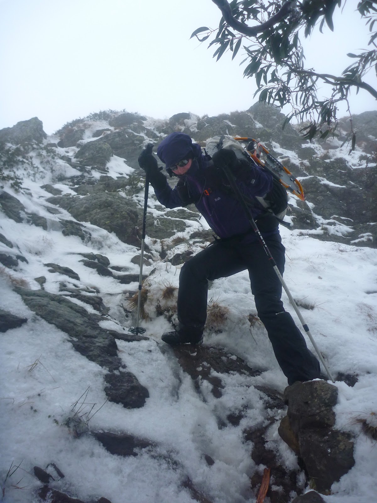
It took until couple of weekends ago for us to return to the mountains in which we'd met. In the intervening months winter has come, and so we decided to go to one of the best destinations for a play in the snow.
The Bluff is a magnificent peak located 10km south of Mount Buller in the Alpine National Park. The northern face of the mountain features rugged cliffs, whilst the southern side of the mountain is far more mundane, falling away at a consistent slope down to the Jamieson River. Due to this interesting southerly aspect it holds snow well and provides fantastic opportunities for skiing and snowplay.
The walk begins at a gradual gradient, then starts to steepen up, eventually reaching the point where you use all fours. The summit is only 1.5km from the carpark, although some 400 vertical metres in height must be gained to get there.
We set off from Refrigerator Gap carrying overnight packs and snowshoes. I threw in a pair of tele skis for good measure. As usual there was no snow at the gap itself, however as we reached the steeper section patches began to appear.
The main face of the mountain faces north, so the snow melts quickly. Fortunately for us it had snowed the previous evening which made the scenery prettier than usual.
As we climbed higher the afternoon sun cast beautiful light upon us, and we had magnificent views over the Howqua valley towards Mount Buller
Upon reaching the crest of the ridge we found the weather was abysmal. Visibility was poor and the wind was gusty and strong. We travelled a mere 200m to a slightly more sheltered position, carved out a rough platform and pitched the tent, anchoring it to the snow in as many locations as possible. Getting inside was a great relief.
That evening the wind howled, and each of us only emerged from the tent on one occasion. It was the first time Tahl had taken her tent into the snow; a baptism of fire. The following morning we awoke to hear more wind, and upon emerging from the tent we saw the visibility hadn't improved. Up to 30cm of snow had fallen during the night.
We soon abandoned our snowshoeing and skiing ambitions due to the adverse conditions. There was little point spending more time up top, so we packed up and headed off the mountain.
As is often the case, the dreadful conditions up top were hardly evident by the time we got down to the carpark. Overall, a great little walk despite the weather. We'll be back some other time to enjoy the delights of this easily accessible alpine playground.
Saturday, 14 April 2012
Razor-Viking circuit from the Howqua
The rugged peaks and ranges in the heart of the Victorian High Country are a major drawcard for bushwalkers. The country here is consistently steep and rough; a marked contrast to the more rounded areas of the Australian Alps to the north-east. The jewel in the crown is the area located around Mount Howitt, a 1700m peak on the crest of the Great Dividing Range. Walkers flock to the narrow knife-edge ridge known as the Crosscut Saw, admire the views from Mount Howitt and enjoy the delights of Mount Speculation. Other landmarks in the area are less welcoming, featuring names such as the Terrible Hollow, Mount Despair, Horrible Gap, the Devil's Staircase, Mount Buggery and The Razor.
Most people access this spectacular area from the Howitt Plains, an alpine plateau located north of the remote mountain town of Licola. The high starting altitude provides relatively easy access to the area, and it is quite common to see young families doing day trips to Mount Howitt. It is also the starting point for one of the best four day walks in Victoria; the Razor-Viking circuit. Setting off from the Howitt Plains, this circuit heads clockwise around the crest of the mountain ranges, from Macalister Springs to Mount Howitt, across the Crosscut Saw to Mount Buggery and Speculation, down to Catherine Saddle, up over Mount Despair, across the southern flank of The Razor, then up through the cliffs to The Viking. From here bushwalkers descent from the ranges down into the depths of the Wonnangatta valley, before ascending 1000m back up to the Howitt Plains.
For those of us who live in Central Victoria accessing the Howitt Plains involves a rather lengthy drive that nearly circumnavigates the Alps. Instead, many of us opt to come in from the west via the town of Mansfield, saving several hours in travel. However, the reduced travel time comes at a price: altitude. Access from this side of the mountains involves starting from the valleys of the Howqua, Jamieson or King Rivers and climbing up to a thousand vertical meters to reach the crest of the range. It adds difficulty to the walks, but for some of us that's part of the attraction.
My goal for this trip was to complete the classic four day circuit from the west, starting and finishing at the Upper Howqua Camping Area.
The first 5km or so of walking entails following the Howqua River upstream along an old vehicle track. It's been closed to traffic for years, but some enterprising people in a 4WD have recently cut their way in along it. It required a substantial amount of effort in places, including filling in an erosion gully in order to get their cumbersome vehicles past.
Further upstream I noticed that the last remaining bridge on the track was missing, presumably having fallen victim to the recent floods. Fortunately others had provided stepping stones across the river instead, saving people from removing their boots for each crossing.
Upon reaching the base of the Howitt Spur walking track I turned left, following an old logging track up towards the crest of the Thorn Range. This track climbs at a steady pace but ducks and weaves all over the place, with false summits around seemingly every corner. At the actual crest I turned right along a walking track, heading up Stanley Name Spur. Passing over a slight hill and down through a small campsite perched in a saddle, the track then climbs straight up the side of one of the 'teeth' of the Crosscut Saw. The ascent is steep, and in places you need to use your hands to scramble up through the rocks - my kind of bushwalking!
After having lunch at the top of the spur, I set out along the well-worn foot track along the Crosscut Saw itself. The track ducks and weaves amongst the 'teeth', heading around some and straight over others. In places the ridge is quite narrow, making for spectacular walking.
The next major feature on the ridge north of the Crosscut Saw is Mount Buggery, with its rounded tree-clad summit providing an ideal campsite for those who are prepared to carry water. From the summit the track plummets down to Horrible Gap, before commencing a slightly gentler ascent up Mount Speculation. The south face of this mountain is particularly scenic.
One of the unique features of Mount Speculation is the amazing camping that is available, right on the edge of an escarpment overlooking the Terrible Hollow. I decided to take full advantage of this, so after resting briefly at the summit I headed north-east for a couple of hundred metres to a suitable location to pitch the tent. There were already a few tents set up, and I had seen a couple of parties making their way along the Crosscut Saw, so I staked my claim around 4:30pm and picked up some water from where the vehicle track crosses Camp Creek. Quickly cooked tea then went to bed at an early hour, hoping to catch up on lost sleep.
Day 2 - Mount Speculation to The Viking
One of the issues with camping in exposed locations is the drama that unfolds once the weather turns. Partway through the night the wind picked up significantly, to the point where I began to become concerned about the snowgums above my tent. Usually I have no problem with camping beneath snowgums as they usually only shed branches under heavy snow loading in the depths of winter. However, as I listened to each mighty gust of wind roaring in from the north and braced myself for each impact, I decided that it would be safer if I shifted my tent out of harms way in case the worst happened. Once this was done I could finally go back to sleep.
When dawn broke it was a glorious day, with the wind gone and nothing to distract me from the magnificent view from the campsite.
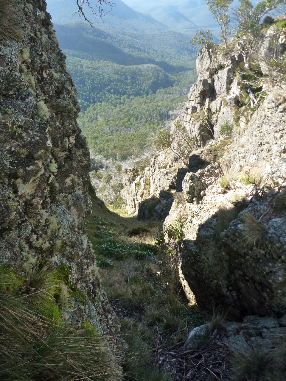
Broke camp and set off around 9am, opting to take the foot track along the ridge instead of the longer vehicle track. I was glad I did, as the scenery was magic. Spotted a fantastic chute down from the ridge into the Terrible Hollow, featuring a tight rocky entrance and an ideal orientation. I'd love to ski it someday.
The track follows the ridge for around 1km before plummeting down the steep side of the hill to reach the vehicle track near Catherine Saddle. This descent, although brief, can be hard on your knees and I think people attempting to climb up it would have significant traction issues. Upon reaching the vehicle track I followed it around to Catherine Saddle itself, noting that someone had been down here with a 4WD recently. As it turned out it must have been a Parks Victoria vehicle, as the track heading east from the saddle had recently been cleared. This made progress very easy all the way to the tree-clad summit of Mount Despair. Partway up there was a gap in the trees, offering good views back towards the Crosscut Saw.
Upon reaching the summit I had a break, and was about to pack up and leave when I heard a noise nearby. Looking around, I spotted a friendly reptile that must have wanted a bit of company.
Descending from the summit, the track drops down to the crest of a rocky ridge leading to The Razor. The next stretch of track is very rugged and can be quite elusive. Generally the track sits below the crest of the ridge, but never drops down to the gully. Occasionally it gets close to the crest of the ridge, where there are views to the summit of the Razor itself.
Even though I'd walked this section of track before I still lost it towards the end, and had to climb up the hill to reach the ridge at the end of the Razor. Here I had a one hour lunch break, then continued along towards Viking Saddle. The track here had not been cleared, and regrowth through the decimated Ash forest was thick.
In places the track was hard to follow, but fortunately the second half of the track had been cleared, making the last section down to Viking Saddle itself quite easy. The saddle itself was as I remembered it, with the rocky cliffs of The Viking towering above it.
As I wanted to camp on the summit it was necessary to cart water from the bottom, so I set off down the foot track on the eastern side of the saddle, heading to the north in search of water to fill my containers. As on all my other visits to the area, water was found just before a little rocky escarpment that would form a waterfall after heavy rain. There must be a spring in the area, as not far upstream the creek bed was bone dry.
Returning to the saddle, I put the pack on and began the ascent up to The Viking itself. The ascent profile is similar to an exponential curve, starting off with a moderate gradient and getting steeper and steeper, until becoming near vertical towards the end where it passes through the rock band that forms the prominent cliffs. The track itself avoids the cliffs by heading up through a rugged chute, and in two sections passes through small caves formed by huge boulders.
At around 5:30pm I reached the summit, which is my favourite in Victoria. Despite its mere 1500m elevation, it feels like the top of the world.
I set off to the north and set up camp on a small grassy flat less than 50m away from the edge of the cliffs, started cooking dinner and then headed up to the edge of the cliffs to enjoy the sunset.
After the sun went down I could see the glow of a campfire down in Viking Saddle itself. If only the people down there knew what they were missing out on up at the summit. The temperature soon plummeted, so I retreated to the mild warmth offered by my 0ยบ sleeping bag. It must have reached that temperature at one point in the night, as at some stage I woke up and the fly was covered in ice.
Day 3 - The Viking to Macalister Springs
Awoke in the morning to a heavy dew and a saturated fly. The clear skies of the previous day had been replaced by broken cloud cover, depriving me of a scenic sunrise.
Setting off a little after 8am, I climbed back to the summit and began heading towards the South Viking, when I heard voices coming up the hill. It turned out to be two bushwalkers from Newcastle, John and Claire. They had spent the night at Viking Saddle and were hoping to get back to the carpark at Howitt Plains that evening, so we decided to stick together for the day.
Upon reaching the top of the South Viking, we began descending the spur down to the Wonnangatta River. The regrowth was much more mild than the previous day, and there was a decent footpad in a lot of places. We made good time to the river, arriving before midday.
There was little trace of the old vehicle track that once headed along the river, and both banks were covered in large quantities of blackberries. This made progress slow, with the only compensation being that the blackberries were ripe... and delicious.
From the river we had two options; follow the old vehicle track up to the Zeka Spur 4WD track and trudge through the dust, or cut up an unnamed and untracked spur to intersect the main spur above the 4WD track. We opted for the former, in case we could hitch a lift, and to avoid any regrowth issues.
The Zeka Spur track is one of the main 4WD access routes into the remote Wonnangatta valley, and Easter is one of the most popular times of year. Consequently the track and all the vegetation either side is covered in dust, with the lingering scent of diesel in the air. We had a brief lunch and then commenced the march up the track, which is steep, uninteresting and generally unpleasant. Only two vehicles passed us going in our direction, and neither stopped. The rest of the traffic was heading down the hill. At one stage a vehicle pulled over and a lady called out, 'Are you guys intentionally walking?'!!! Says a lot about the 4WD mentality. We were relieved to find the intersection of the old track and the new, marked by a small stone cairn on a sharp bend.
At this stage we were starting to feel a little weary, but there were still a number of kilometres to go, so on we went. We came across a couple of walkers camped in a saddle, who had walked down the track to the Wonnangatta the previous day and marched back out again that morning. One of them described the ascent as 'soul destroying'.
Further along the track began to climb at a steady grade, and at one point there were views back to where we had come from earlier in the day.
The ascent seemed to drag on and on, and it was getting cold by the time we reached the intersection with the track into Macalister Springs. Here I bid the John and Claire adieu and set off towards Macalister Springs. The track in had been churned up recently by some sort of wheeled vehicle; apparently they have been doing some work on the toilet.
By the time I reached the campsite it was dark, and after briefly stopping to absorb some warmth from a roaring campfire I started searching for a friend of mine, Gary, who had walked in for the evening. The hut was packed with people singing campfire songs which wasn't my kind of scene, so I explored further and ran into Gary standing around another campfire with three others; James, Jolie and Natahl. I quickly set up the tent nearby and returned to the fire to cook tea and be social. As the evening wore on the temperature kept dropping and the fire got progressively smokier, and eventually my weary body decreed that it was time for bed. Fair enough too; it had been a 20km day with well over 1000m of ascent.
Day 4 - Macalister Springs to Upper Howqua Camping Area
The weather had deteriorated somewhat overnight, leaving the morning cold and damp. There were intermittent showers of rain and ice, but no snow. Gary left bright and early in the morning, opting to retreat to the warmth of Licola for a cooked breakfast. In the absence of a fire and amidst the rather cool air I could certainly see the logic of his plan.
James and Jolie kindly invited me over to their spacious Hilleberg tent for breakfast, an offer which I graciously accepted. Their tent had quite a sculptural form, seemingly emerging from the ground similar the rounded top of a deeply embedded granite boulder. The clean lines were broken by the many guy ropes protruding from the tent like spines from an echidna.
Following an unusual entry procedure that favours the more agile members of society, I found myself contained within its yellow and green walls. Natahl joined us, creating a close-knit environment that I felt quite comfortable in... until James insisted that I cook inside the vestibule.
Now, as an MSR liquid fuel stove user and somebody who can have a quite conservative nature, this is something I'm never comfortable doing. I usually only cook in vestibules in the snow, and only after the vestibule has been dug out to provide more space. As an added precaution I opt to prime outside, lest the stove flare up and cause harm. Everyone's heard, seen or knows someone who's been involved with a liquid fuel accident and I would hate to be the cause of such an event. So you can imagine my apprehension about cooking in a brand new, extremely expensive tent with a bunch of people I barely knew, running the risk of turning the whole lot into a molten mess of nylon and flesh in a matter of seconds.
James was extremely good natured about the whole concept, insisting being able to cook in the vestibules was his number one selection criteria when choosing a tent, and that he would be using his XGK in the vestibule anyway, so what was the problem? I still couldn't bring myself to potentially cause harm to the tent, and after more banter Natahl encouraged me to "live a little, burn it down!”
Well, her statement floored me. How could I defend myself against that? So, nervously, I lit the stove. There was no excessive flame. The tent still stood, intact. We were still alive. Life went on. Goes to show you how sometimes you build these mental barriers that seem insurmountable, yet often they really aren't that big a deal and be easily conquered using a different mindset. I reflected on Natahl's "live a little" statement a lot over the next couple of days, and am definitely a better person for it.
Amongst much conversation and many cups of tea we consumed breakfast in a social manner, and all too soon I had to leave, as there was still a few kilometres to go until I reached the finishing point. Farewelling my companions, I set off towards Mount Howitt at around 10:45am. Occasional breaks in the cloud allowed tantalising glimpses of the previous days walking, including some great views back towards The Viking.
As I neared the summit I was surprised to see an unusual object just metres away from the survey mark; a tent. Not something you see every day up there, and certainly not in low visibility with the wind blasting through.
Here I faced a difficult decision; to continue on over Mount Magdala and head back to the car via one of my favourite routes, Helicopter Spur, or to descend directly down the less pleasant Howitt Spur and then along the Howqua River. The low temperature and strong winds soon chilled me off, so I opted for the more direct Howitt Spur route. A small gap in the clouds allowed me one last glimpse back across to the Crosscut Saw to The Razor and The Viking, and then I began the descent.
The rest of the walk was fairly straightforward, and I arrived back at the car just before 2:30pm. A check of the GPS revealed that I had ascended 3,850m over the walk and had covered 62.8km.
Reflections
This walk was simply fantastic. Considering it was one of the most popular times of year the crowd levels were quite acceptable, and the terrain covered second to none. The third day was longer and harder than many would like, but I believe that for a fit party it is perfectly achievable. In future I would head up the untracked spur instead of the Zeka Spur track, and would finish the walk by heading over Mount Magdala and descending via Helicopter Spur on the final day.
With these minor adjustments I believe this would be Victoria's ultimate four day circuit.
Most people access this spectacular area from the Howitt Plains, an alpine plateau located north of the remote mountain town of Licola. The high starting altitude provides relatively easy access to the area, and it is quite common to see young families doing day trips to Mount Howitt. It is also the starting point for one of the best four day walks in Victoria; the Razor-Viking circuit. Setting off from the Howitt Plains, this circuit heads clockwise around the crest of the mountain ranges, from Macalister Springs to Mount Howitt, across the Crosscut Saw to Mount Buggery and Speculation, down to Catherine Saddle, up over Mount Despair, across the southern flank of The Razor, then up through the cliffs to The Viking. From here bushwalkers descent from the ranges down into the depths of the Wonnangatta valley, before ascending 1000m back up to the Howitt Plains.
For those of us who live in Central Victoria accessing the Howitt Plains involves a rather lengthy drive that nearly circumnavigates the Alps. Instead, many of us opt to come in from the west via the town of Mansfield, saving several hours in travel. However, the reduced travel time comes at a price: altitude. Access from this side of the mountains involves starting from the valleys of the Howqua, Jamieson or King Rivers and climbing up to a thousand vertical meters to reach the crest of the range. It adds difficulty to the walks, but for some of us that's part of the attraction.
My goal for this trip was to complete the classic four day circuit from the west, starting and finishing at the Upper Howqua Camping Area.
Day 1 - Upper Howqua Camping Area to Mount Speculation
Following a late arrival in the wee hours of the morning, it took quite some effort to extract myself from bed and set out from the Upper Howqua Camping Area at 8am. The camping area itself was closed due to flood damage, with the old river crossing looking a little worse for wear.The first 5km or so of walking entails following the Howqua River upstream along an old vehicle track. It's been closed to traffic for years, but some enterprising people in a 4WD have recently cut their way in along it. It required a substantial amount of effort in places, including filling in an erosion gully in order to get their cumbersome vehicles past.
Further upstream I noticed that the last remaining bridge on the track was missing, presumably having fallen victim to the recent floods. Fortunately others had provided stepping stones across the river instead, saving people from removing their boots for each crossing.
Upon reaching the base of the Howitt Spur walking track I turned left, following an old logging track up towards the crest of the Thorn Range. This track climbs at a steady pace but ducks and weaves all over the place, with false summits around seemingly every corner. At the actual crest I turned right along a walking track, heading up Stanley Name Spur. Passing over a slight hill and down through a small campsite perched in a saddle, the track then climbs straight up the side of one of the 'teeth' of the Crosscut Saw. The ascent is steep, and in places you need to use your hands to scramble up through the rocks - my kind of bushwalking!
After having lunch at the top of the spur, I set out along the well-worn foot track along the Crosscut Saw itself. The track ducks and weaves amongst the 'teeth', heading around some and straight over others. In places the ridge is quite narrow, making for spectacular walking.
The next major feature on the ridge north of the Crosscut Saw is Mount Buggery, with its rounded tree-clad summit providing an ideal campsite for those who are prepared to carry water. From the summit the track plummets down to Horrible Gap, before commencing a slightly gentler ascent up Mount Speculation. The south face of this mountain is particularly scenic.
One of the unique features of Mount Speculation is the amazing camping that is available, right on the edge of an escarpment overlooking the Terrible Hollow. I decided to take full advantage of this, so after resting briefly at the summit I headed north-east for a couple of hundred metres to a suitable location to pitch the tent. There were already a few tents set up, and I had seen a couple of parties making their way along the Crosscut Saw, so I staked my claim around 4:30pm and picked up some water from where the vehicle track crosses Camp Creek. Quickly cooked tea then went to bed at an early hour, hoping to catch up on lost sleep.
Day 2 - Mount Speculation to The Viking
One of the issues with camping in exposed locations is the drama that unfolds once the weather turns. Partway through the night the wind picked up significantly, to the point where I began to become concerned about the snowgums above my tent. Usually I have no problem with camping beneath snowgums as they usually only shed branches under heavy snow loading in the depths of winter. However, as I listened to each mighty gust of wind roaring in from the north and braced myself for each impact, I decided that it would be safer if I shifted my tent out of harms way in case the worst happened. Once this was done I could finally go back to sleep.
When dawn broke it was a glorious day, with the wind gone and nothing to distract me from the magnificent view from the campsite.
Broke camp and set off around 9am, opting to take the foot track along the ridge instead of the longer vehicle track. I was glad I did, as the scenery was magic. Spotted a fantastic chute down from the ridge into the Terrible Hollow, featuring a tight rocky entrance and an ideal orientation. I'd love to ski it someday.
The track follows the ridge for around 1km before plummeting down the steep side of the hill to reach the vehicle track near Catherine Saddle. This descent, although brief, can be hard on your knees and I think people attempting to climb up it would have significant traction issues. Upon reaching the vehicle track I followed it around to Catherine Saddle itself, noting that someone had been down here with a 4WD recently. As it turned out it must have been a Parks Victoria vehicle, as the track heading east from the saddle had recently been cleared. This made progress very easy all the way to the tree-clad summit of Mount Despair. Partway up there was a gap in the trees, offering good views back towards the Crosscut Saw.
Upon reaching the summit I had a break, and was about to pack up and leave when I heard a noise nearby. Looking around, I spotted a friendly reptile that must have wanted a bit of company.
Descending from the summit, the track drops down to the crest of a rocky ridge leading to The Razor. The next stretch of track is very rugged and can be quite elusive. Generally the track sits below the crest of the ridge, but never drops down to the gully. Occasionally it gets close to the crest of the ridge, where there are views to the summit of the Razor itself.
Even though I'd walked this section of track before I still lost it towards the end, and had to climb up the hill to reach the ridge at the end of the Razor. Here I had a one hour lunch break, then continued along towards Viking Saddle. The track here had not been cleared, and regrowth through the decimated Ash forest was thick.
In places the track was hard to follow, but fortunately the second half of the track had been cleared, making the last section down to Viking Saddle itself quite easy. The saddle itself was as I remembered it, with the rocky cliffs of The Viking towering above it.
As I wanted to camp on the summit it was necessary to cart water from the bottom, so I set off down the foot track on the eastern side of the saddle, heading to the north in search of water to fill my containers. As on all my other visits to the area, water was found just before a little rocky escarpment that would form a waterfall after heavy rain. There must be a spring in the area, as not far upstream the creek bed was bone dry.
Returning to the saddle, I put the pack on and began the ascent up to The Viking itself. The ascent profile is similar to an exponential curve, starting off with a moderate gradient and getting steeper and steeper, until becoming near vertical towards the end where it passes through the rock band that forms the prominent cliffs. The track itself avoids the cliffs by heading up through a rugged chute, and in two sections passes through small caves formed by huge boulders.
At around 5:30pm I reached the summit, which is my favourite in Victoria. Despite its mere 1500m elevation, it feels like the top of the world.
I set off to the north and set up camp on a small grassy flat less than 50m away from the edge of the cliffs, started cooking dinner and then headed up to the edge of the cliffs to enjoy the sunset.
After the sun went down I could see the glow of a campfire down in Viking Saddle itself. If only the people down there knew what they were missing out on up at the summit. The temperature soon plummeted, so I retreated to the mild warmth offered by my 0ยบ sleeping bag. It must have reached that temperature at one point in the night, as at some stage I woke up and the fly was covered in ice.
Day 3 - The Viking to Macalister Springs
Awoke in the morning to a heavy dew and a saturated fly. The clear skies of the previous day had been replaced by broken cloud cover, depriving me of a scenic sunrise.
Setting off a little after 8am, I climbed back to the summit and began heading towards the South Viking, when I heard voices coming up the hill. It turned out to be two bushwalkers from Newcastle, John and Claire. They had spent the night at Viking Saddle and were hoping to get back to the carpark at Howitt Plains that evening, so we decided to stick together for the day.
Upon reaching the top of the South Viking, we began descending the spur down to the Wonnangatta River. The regrowth was much more mild than the previous day, and there was a decent footpad in a lot of places. We made good time to the river, arriving before midday.
There was little trace of the old vehicle track that once headed along the river, and both banks were covered in large quantities of blackberries. This made progress slow, with the only compensation being that the blackberries were ripe... and delicious.
From the river we had two options; follow the old vehicle track up to the Zeka Spur 4WD track and trudge through the dust, or cut up an unnamed and untracked spur to intersect the main spur above the 4WD track. We opted for the former, in case we could hitch a lift, and to avoid any regrowth issues.
The Zeka Spur track is one of the main 4WD access routes into the remote Wonnangatta valley, and Easter is one of the most popular times of year. Consequently the track and all the vegetation either side is covered in dust, with the lingering scent of diesel in the air. We had a brief lunch and then commenced the march up the track, which is steep, uninteresting and generally unpleasant. Only two vehicles passed us going in our direction, and neither stopped. The rest of the traffic was heading down the hill. At one stage a vehicle pulled over and a lady called out, 'Are you guys intentionally walking?'!!! Says a lot about the 4WD mentality. We were relieved to find the intersection of the old track and the new, marked by a small stone cairn on a sharp bend.
At this stage we were starting to feel a little weary, but there were still a number of kilometres to go, so on we went. We came across a couple of walkers camped in a saddle, who had walked down the track to the Wonnangatta the previous day and marched back out again that morning. One of them described the ascent as 'soul destroying'.
Further along the track began to climb at a steady grade, and at one point there were views back to where we had come from earlier in the day.
The ascent seemed to drag on and on, and it was getting cold by the time we reached the intersection with the track into Macalister Springs. Here I bid the John and Claire adieu and set off towards Macalister Springs. The track in had been churned up recently by some sort of wheeled vehicle; apparently they have been doing some work on the toilet.
By the time I reached the campsite it was dark, and after briefly stopping to absorb some warmth from a roaring campfire I started searching for a friend of mine, Gary, who had walked in for the evening. The hut was packed with people singing campfire songs which wasn't my kind of scene, so I explored further and ran into Gary standing around another campfire with three others; James, Jolie and Natahl. I quickly set up the tent nearby and returned to the fire to cook tea and be social. As the evening wore on the temperature kept dropping and the fire got progressively smokier, and eventually my weary body decreed that it was time for bed. Fair enough too; it had been a 20km day with well over 1000m of ascent.
Day 4 - Macalister Springs to Upper Howqua Camping Area
The weather had deteriorated somewhat overnight, leaving the morning cold and damp. There were intermittent showers of rain and ice, but no snow. Gary left bright and early in the morning, opting to retreat to the warmth of Licola for a cooked breakfast. In the absence of a fire and amidst the rather cool air I could certainly see the logic of his plan.
James and Jolie kindly invited me over to their spacious Hilleberg tent for breakfast, an offer which I graciously accepted. Their tent had quite a sculptural form, seemingly emerging from the ground similar the rounded top of a deeply embedded granite boulder. The clean lines were broken by the many guy ropes protruding from the tent like spines from an echidna.
Following an unusual entry procedure that favours the more agile members of society, I found myself contained within its yellow and green walls. Natahl joined us, creating a close-knit environment that I felt quite comfortable in... until James insisted that I cook inside the vestibule.
Now, as an MSR liquid fuel stove user and somebody who can have a quite conservative nature, this is something I'm never comfortable doing. I usually only cook in vestibules in the snow, and only after the vestibule has been dug out to provide more space. As an added precaution I opt to prime outside, lest the stove flare up and cause harm. Everyone's heard, seen or knows someone who's been involved with a liquid fuel accident and I would hate to be the cause of such an event. So you can imagine my apprehension about cooking in a brand new, extremely expensive tent with a bunch of people I barely knew, running the risk of turning the whole lot into a molten mess of nylon and flesh in a matter of seconds.
James was extremely good natured about the whole concept, insisting being able to cook in the vestibules was his number one selection criteria when choosing a tent, and that he would be using his XGK in the vestibule anyway, so what was the problem? I still couldn't bring myself to potentially cause harm to the tent, and after more banter Natahl encouraged me to "live a little, burn it down!”
Well, her statement floored me. How could I defend myself against that? So, nervously, I lit the stove. There was no excessive flame. The tent still stood, intact. We were still alive. Life went on. Goes to show you how sometimes you build these mental barriers that seem insurmountable, yet often they really aren't that big a deal and be easily conquered using a different mindset. I reflected on Natahl's "live a little" statement a lot over the next couple of days, and am definitely a better person for it.
Amongst much conversation and many cups of tea we consumed breakfast in a social manner, and all too soon I had to leave, as there was still a few kilometres to go until I reached the finishing point. Farewelling my companions, I set off towards Mount Howitt at around 10:45am. Occasional breaks in the cloud allowed tantalising glimpses of the previous days walking, including some great views back towards The Viking.
As I neared the summit I was surprised to see an unusual object just metres away from the survey mark; a tent. Not something you see every day up there, and certainly not in low visibility with the wind blasting through.
Here I faced a difficult decision; to continue on over Mount Magdala and head back to the car via one of my favourite routes, Helicopter Spur, or to descend directly down the less pleasant Howitt Spur and then along the Howqua River. The low temperature and strong winds soon chilled me off, so I opted for the more direct Howitt Spur route. A small gap in the clouds allowed me one last glimpse back across to the Crosscut Saw to The Razor and The Viking, and then I began the descent.
The rest of the walk was fairly straightforward, and I arrived back at the car just before 2:30pm. A check of the GPS revealed that I had ascended 3,850m over the walk and had covered 62.8km.
Reflections
This walk was simply fantastic. Considering it was one of the most popular times of year the crowd levels were quite acceptable, and the terrain covered second to none. The third day was longer and harder than many would like, but I believe that for a fit party it is perfectly achievable. In future I would head up the untracked spur instead of the Zeka Spur track, and would finish the walk by heading over Mount Magdala and descending via Helicopter Spur on the final day.
With these minor adjustments I believe this would be Victoria's ultimate four day circuit.
Subscribe to:
Posts (Atom)